Saturday, September 29, 2012

Cotopaxi: my journey to the top

Yesterday I accomplished something that I never imagined I would do.


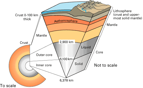
The Volcán Cotopaxi is located on the western cordillera of the Andes mountains in Ecuador, and it is (with some contention due to qualifying adjectives) the third highest active volcano in the world. It erupts roughly once a century, and is due for the 21st century so far. When Cotopaxi erupts, it is explosive and affects the entire country of Ecuador. Cotopaxi greets many of my classmates when they wake up and look out of their windows in the morning, as it is clearly seen in the Quito/Cumbayá skyline with its distinctive white-topped cone. (My host house has a really high fence that blocks city views.) Ambrosia, the bakery at USFQ, also makes cute little Cotopaxi cakes that have the volcano crater shape at the top and is sprinkled with confectioner’s sugar to mimic the glacier cap. I will probably pose with one of these cakes in a picture sometime soon. 

Cotopaxi is 5897 meters in height, which is 19,347 feet. This is 6 feet higher than Mount Kilimanjaro and a little under 5,000 feet higher than Mount Ranier. This is also higher than anywhere I have ever set foot.

So the field trip this week was to inspect volcano deposits in the western cordillera in comparison with the eastern cordillera (which is where Quilotoa, our destination last week, is located). 
We made two geological stops to observe outcrops and landscape features. But really there was a tacit understanding that this trip was mostly about the Cotopaxi summit.

Us at our first geological stop. Juan, who is an important character in this entry, is the stranger on the right listening to Ben's lecturing. (Photo from Ashley)
The concept of summitting a mountain is that it represents a challenge of the body as well as the mind and lets you know a mountain in an intimate way, which might provide the opportunity to see the land around the mountain in a different way, too. It’s never really been something I thought much about until my classes here took me on so many mountain trips. We’d been receiving emails for signing up to summit Cotopaxi for several months now, but I’d largely ignored them because I thought it was too expensive and that I would never be able to train adequately to actually achieve it. And then I realized the entire class, minus one girl whose international program doesn’t allow her above certain altitudes, was signed up to summit... and that if I did manage to summit, it’d stand as my crowning physical achievement. 

So I put my name on the list two weeks before the trip, paid the guides and supplies fee, and started “training.” This training consisted of talking extensively about running trails in Cumbaya with classmates, not actually going on any of these trails and instead running around my very small host neighborhood for an hour twice in the two weeks of preparation, doing intense power yoga a few times, and nearly summitting Rucu Pichincha with two classmates and a guest this Monday. 

A short aside, our Rucu Pichincha story is a little fun, too. We wanted to help a friend from USFQ with hosting her visiting friend from Switzerland while she was away at Tiputini with a class, and so we decided to invite him to join us on a hiking day. It was a marvelous hike - we’d tried to hike Rucu Pichincha, which is the mountain accessible on the Teleférico I’d visited my first week here, the weekend before Quilotoa and found it an extreme challenge. It had taken us two hours to hike half of the trail. This time around, we were at a point ALMOST at the summit in 2 hours. We credit Quilotoa two-fold summitting for our great improvement in performance. The fog cover at the top of Pichincha was really thick and we were starting to feel some raindrops on our heads, so we decided it’d be best to turn back around and call it a day. Except it started to hail really hard. So what took us 2 hours to climb up took us 20 minutes to sprint down because the hail was pretty painful, and the winds were very cold. And then it took us 20 minutes to secure a cab to get back to the Rio Coca bus station in Quito so we could make it back to Cumbaya and get some warm, dry clothes. On the bus I chatted with the lady next to me, and she wants to be a host mom for GAIAS students! The day after, I woke up with a cold. Great. 

But back to the topic at hand. I “trained” for Cotopaxi and was happy with my pleasantly short summit time at Pichincha. It was like my heart muscles decide, “I heard you’re trying to climb a super high volcano this week? Okay, I guess we can up production for a little bit.” (But note: the Pichincha summit was actually a little lower than the place we’d sleep for the night at Cotopaxi. Heh.) 

Wednesday, we went as a class with our professor and with Jennifer, the USFQ international programs assistant person who was going to hike with us, to rent supplies from a tiny understaffed shop in Quito. I came back with 12-pound glacier boots, a thermal fleece, waterproof outer pants (XXL men’s! Woohoo....?), protection 4 sunglasses for the glacial ice brightness, and giant goofy-looking multicolored mittens to wear outside of my biking gloves for added warmth. 

We left for Cotopaxi at 8 am on Thursday and went through some small towns nearby Quito to pick up 4 of our 5 mountaineering guides who would lead us up. The five guides are Christian (who seems to be in charge of the mountaineering group and had the best English and is misleading small and slight), Julio, Juan, Segundo, and Pato. 

Can you see the ridiculous road? Our bus driver was a star. 
The first thing that happened to us when we arrived at the Cotopaxi park after riding through some bumpy and steep dirt roads: we are kicked off of the bus at the parking lot and told to take a 45-minute hike up because no vehicles can reach the Refugio, the hostel-type place where Cotopaxi visitors are housed. 

The only time a 1-kilometer hike takes 45 minutes is when it is up a really steep hill of loose volcanic rocks while carrying heavy bags.
But it cleared up closer to the Refugio. You can see me towards the front - look for the pink raincoat. (Photo by Ashley) 
Fortunately, hot tea and gracious climbing guides acting as serving staff awaited us when we reached the limited-heat, limited-electricity, toilets-only-flush-by-dumping-a-bucket-of-water-down-the-bowl Refugio.
View of the Refugio and the slope we climbed up, taken from the ridge. (Photo by Samantha on my camera)
So we relax there for a bit, drink lots and lots of tea, aren’t given our gear training session because the weather was not good enough to do the demonstration, get super excited to see Esteban join us for the hike, eat dinner (veggie pasta and soup), get a short introduction and orientation from the guides, and go to “sleep” from 7 pm to 11 pm. 

Sunset on the western cordillera, Thursday the 27th. (Photo by Samantha)
More sunset. (Photo still by Samantha. I was too cold to stand outside to take pictures at sunset.)
Our hike was to begin at 12 am and continue only until 7:30 am, at which point everyone had to head down from the glacier and back to the Refuge because of risk of avalanches and other things that happen when glaciers melt, since sunrise is at 6 am at the Equator. The goal was to summit before 7:30 am, which is reasonable because it should take 2 hours to get from the Refuge to the lower edge of the glacier, 2 hours to get past the glacier crevasses and the main ridge, and around 2 hours to get from there to the top. Juan was the main one giving orientation advice on what to expect and what to pack, and he told us that the last third of the summit attempt is all about using your mind to overcome your body. 

With lots of nerves and very little oxygen, our group tucks in to sleeping bags and try to rest for four hours. I couldn’t really breathe and was feeling strangely from the altitude, so I didn’t get much sleep at all. Luckily, I felt fine when we were woken at 11 pm to eat “breakfast” and gear up for leaving at midnight. With warm sugar water and snacks packed, helmets, headlamps, harnesses, and 3 or 4 layers of coats on, we were ready to go. 

The slippery slopes ahead of us. (Picture taken at sunset by Samantha)
The first sight that really struck me as we started our hike was the glimmering of Quito and its suburbs in the far distance behind us. This blog has some good pictures to help augment my illustration. We also used it as reference and inspiration in the two weeks before going. 

We were 12 people - myself and 8 classmates, Ben, Esteban, and Jennifer. Originally, we’d picked out hiking partners and were assigned a particular guide. I was with Laleña as hiking partners with Julio as our guide, but unfortunately as we made our way up the volcanic debris paths, Laleña felt sick and had to turn around with Julio sometime around half an hour into our hike. We ended up with quite a bit of reshuffling of hiking groups. So then I joined the conglomerate of guides and classmates that had formed on the trail. I was then adopted by Segundo to hike with Erika and Lorraine, and subsequently plucked out by Juan when Louise turned back and left Mary alone with him. A little later on, we lost Anna to stomach problems. When we made it to the short rest stop at the edge of the glacier, Ben announced that he had a terrible headache and would be turning around, too. We were dropping like flies! 


Since I was then officially walking with Juan for the hike, he helped me check that my crampons were on properly (what an ugly word, right? They are spiky boot attachments that allow for safe treading through snow and ice.) and roped Mary and I in a line to him. This set-up had myself with about 5 feet of rope behind Juan and Mary with about 10 feet of rope behind me. As we hiked through the lower edge of the glacier in these ropes, I was easily able to keep pace with Juan but we quickly realized that Mary’s pace was not as compatible and he was reluctant to slow down very much. It became an uncomfortable period of us walking, Mary’s rope going very taut, and us pausing for her to catch up. After crossing most of the crevasses in the glacier edge, we came across Jennifer struggling with altitude sickness with her guide, and figured out it would be better to have Mary join her group, which would travel slower than Juan and I. 
So I had my own guide for the hike. Good deal! 

I kept pace really well with him through the insides of the glacier (which are incredible and eery, but it was dark and cold, so my camera would not have done well with it - I brought an actual camera on the hike this time.) and could do just fine on the extreme slopes if I didn’t look up and asked for him to slow down a little bit. My cold wasn't bothering me, my lungs and heart felt normal. I was very lucky! 

We stopped for a short break in an ice cave at one point and when I asked him how far we were from the summit. Juan said, “That is not a good question. Just keep walking.” 

This song played in my head quite a bit as we hiked, one step at a time... 

As we got further up it became much more challenging because the steep slopes are steeper, the air gets progressively thinner and colder, and the glacial coverage has a higher concentration of snow versus slush. I tackled and achieved the slopes mostly through yogic breathing, not looking up to see how much more I had to go, following step by step how Juan was moving, and employing my self-assuring breaths that I’d figured out in Quilotoa. 

After we got around the main ridge, the slopes became positively ridiculous. It was a little ironic that the point of the night when my body was most exhausted was the point most crucial to deciding whether I’d make the summit by sunrise and the point where the slopes become really hard to manage. Cotopaxi is not an overly technical mountain to climb, meaning it’s not required to have special gear (besides crampons and ice axes, which we used as walking sticks and stability tools) or technical training to try to climb it. However, some of the snow slopes were so steep I was reduced to hands and knees trying to overcome them. 

This is the ridge we were crossing during sunrise, which happens to be somewhere near the first third of the extreme slopes. 

Me at sunrise. Helmets do not provide my best look. 
Couldn't really grasp how much further we had to go. 

The portion of the hike directly before the summit was when I had my most challenging moments. There are five or six steep snow slopes that require really strong leg work, careful balancing, and well-managed breathing, but at this part of the night my body was reaching its breaking point. I was exhausted from a shortage of sleep and oxygen and an excess of boot weight on my legs, I’d been climbing steeply inclined trail for the past six hours, and I really had no experience attempting a hike longer than 5 hours at once before. 

At these slopes, I would take a few steps, try to call on all of my positive thinking, careful breathing, and special envisioning to keep on moving as steadily and quickly as I had been for the first two thirds of the hike or at least in a steady manner at all, but I was invariably reduced to a desperately panting and really upset pile of Jackclyn and gear in the snow at each slope. 

Juan was incredibly patient with my whining. I think I whined more on this summit than I have to anybody in a single day, including my mom. He coached my breathing, assured me I was doing well on the climb, and reminded me to take it slowly and just keep breathing and stepping steadily. I would whimper that I was trying to do exactly that, attempt to continue with a war grunt to stand up, take a few good steps, and end up collapsed and upset again. I felt like I was losing control of my body, and as much as I mentally wanted to reach the summit it seemed like my depleted muscles were disagreeing. 

At the last four slopes before the summit, I started making a really bizarre noise when I tried to keep moving. It was extremely guttural in nature and was the saddest sound I think I’ve ever heard myself making; a strong mix of frustration that I couldn’t really control my body, couldn’t feel a full lung of air, the pain in my body that I felt with every move, and the tiredness of such an extremely long hike especially after I looked up to see how much further the slope extended. At the last slope, Juan was feeling really worried that I’d made it so far but was so obviously struggling to even stand up. Two thirds of the way in, he had assured me that since I made it that far already I would definitely make it to the top. I wanted so much for him to be correct. 

I started the night with one breath’s pause between steps on challenging slopes, and by the end of the hike up could hardly bring myself to shift a foot with six or more deep breaths between. 

At the last slope after I’d collapsed and retried ascending for about 10 minutes and didn’t make any progress, Juan offered to help me to the summit by being a moving walking stick for me, where I grasped onto his backpack and follow his steps. It actually worked to help keep me moving. As a very frustrated and exhausted me trudged up the slopes on Juan’s back, we crossed paths with Ashley, Samantha, and Esteban on their way down, who all congratulated me for being about 5 minutes from achieving the summit and was as happy to see me as I was to see them. 

Ashley and Esteban's picture at the summit. I was struggling up the slopes at this moment. (Photo taken from Ashley)
Upon reaching the summit, I wasn’t ready for my reaction. I was overwhelmed with wonder at what I had just done and was completely stunned by the view. All of Ecuador was visible from where we stood. My whole body was worn out, but I had reached my goal. I had made it. 

The journey to the summit seemed like a bit of a metaphor for me: I don’t necessarily have all of the resources to do everything on my own, but with the physical and emotional help of others and the right pacing for milestones, there is no goal too hard to achieve. I’m sure I can compose a poem that compiles my feelings about this much better once I get a chance to just sit and feel. 

So I took some pictures, admired the incredible view with Juan, and had to head back down around 7:40 or so because the sun was coming up. 

The crater of Cotopaxi and the south of Ecuador in the distance. 
The edge of the last slop on the bottom right, the southwest of Ecuador in the distance. 
I basically fell into a sitting position trying to pose for this picture. 
Antisana volcano in the north
More of the crater.

Juan (with some dried guayaba in his mouth) and me. 


I insisted on posing with a random Irish couple, not sure why. I'd chatted with them at the Refugio where we tried to sleep the night before.  
The west of Ecuador and Juan. 
I thought the hike back would be easier than it was. At first it was fine since I was still really pumped up from the summit, and the insane slopes down from the top weren’t as bad as on the way up. I chatted with Juan and found out he’s 31, has a degree from some university in Quito in Industrial Engineering, but he doesn’t do any engineering and instead is a hired climbing guide, owns an outdoor supply shop and a bouldering wall, and also runs an outdoor boot repair shop on the side. His older sister lives in Germany with her husband. He wants to improve his English (I think most of our conversation was in Spanish) and admires the beauty in mountains all over the world. 
But when the slopes didn’t get any easier on the way down and I started becoming aware of the exhaustion in my muscles again, I couldn’t converse amicably anymore. 

Ashley snapped a picture of me right about where my conversation with Juan stopped. 

Some things I either thought or said aloud to Juan: 
“There is no way I climbed up this slope. I don’t remember doing this.” (Probably because you were so tired you didn’t notice.)
“I need a break.”
“Can I just sit and slide down this snow? It’d be a lot easier and faster than climbing.” (No, you'll ruin your pants and harness.) 
“How much does the helicopter cost to ride back on?” ($9000. I whimpered and kept trudging.) 
“I need to rest.” 
“There’s not another way around that up-slope? Can I cut a new path in the glacier around it?” 
“I just fell. I need to take a break.”
“I need to breathe here.” 
“I need to sit and drink water.” 
“I’m really sorry that I’m so slow now.” (“You’re destroyed.” he remarked. "Don't be sorry, you made it to the summit. You're a fighter. You're just worn out now.") 
“When does the ice stop?” 
“I am covered with slush from falling.” 
Once we were out of the glacier we were able to shuffle-slide down the volcanic debris along the side of the mountain, but I was so tired that it was hard to control my legs and I fell every few hundred meters - maybe about 15 times or so. Each fall counted as a break time for me, and then Juan would help me up again and lead me shuffling down by the hand. He kept assuring me I could push or pull him to stay upright, but I was reluctant to do so and didn’t really have reflexes to recover my balance before falling, so I have lots of bruises now. 

But I made it back to the Refugio around 11:30. And Juan made me a cup of hot chocolate, Christian carried most of my heavy things back to the bus where everyone else was waiting, and Ben and Esteban came and met me at the edge of the parking lot to congratulate me and give me hugs. 

Beautiful day. 

The three of us who made it to the summit, taken after lunch at a nice restaurant. 

Sunday at 5:30 am, I leave Cumbaya for the Galápagos. One week in Isabela for final Geology class happenings, and then to San Cristobal for the rest of the semester! 

Sunday, September 23, 2012

How does the Earth work?


AND FINALLY I have caught up to this week! 

Monday the 17th marked the first day of Mountain Geology class. My professor, Ben, is French and sometimes a little hard to understand when he is using technical terms. We ask for spelling a lot. 
It was an introduction to the class, the basics about types of rocks, how they are formed, and how to identify them. I don’t have a particularly strong interest in sharing the details about rocks with you, but I’m happy to address any questions if you have them. 

Tuesday’s class was about the formation of the world, so that was more fun. 
The most commonly accepted consensus about the formation of the universe: 
The universe was formed during the shrinking of a nebula, maybe due to energy received from a supernova. Particles came together and took on a rotation motion that created a disc of matter; the materials gained gravity and released heat as light elements - especially hydrogen and helium - had nuclear fusion reactions and started growing a protosun. Denser elements formed planetesimals and eventually came to orbit the sun. Highly radioactive elements like Ca-41 and Al-26 quickly decayed and released extreme heat that melted elements and melted the materials that would become earth. Once melted, things shifted so denser particles settled in the core and lighter ones were suspended further away from the core. 
And then we learned about the layers of the earth and the 3 types of volcanism that create landmass. A simplified diagram follows that gives the gist of the layers: 


Wednesday we discussed lithospheric aka tectonic plates and convergent and subduction zones. After class, I went with Anna to Old Town Quito, where we explored several churches and the City Museum. I will perhaps load those pictures a bit later. I went to dinner with some classmates and came back to my host house to find it empty -- it turns out my host dad had a small stroke that day and was transported to the hospital. It agitated his heart, as a result of a heart attack he'd had 11 years ago, but he came back on Saturday and is feeling very much better. He doesn't seem to have complications. 

Thursday was about crustal deformation as a result of tectonic plate convergence and divergence, types of faults and folds, and earthquakes and volcanoes. This was my favorite day so far. 

This shows the age of the seafloor at different parts of the world. The redder area by the Pacific coast of South America is along the East Pacific Ridge, which spreads very quickly. The Galapagos hotspot along with the East Pacific Ridge created the Nazca plate and the Cocos plate, which subduct under the South American plate and cause all the volcanoes and earthquakes in the region. 

Friday we left at 8 am for our trip to Quilotoa, during which we made plenty of stops to make observations and record data about the landscape surrounding the volcano. 
The second or third stop we made was to examine this fold in the earth, conveniently cut through by road construction so that we could look at specific parts of it. 

This is Ben, my geology professor. There the feature of interest is the break in the rock striations as a result of activity along an inverse fault occurring after the effects of the compression causing the fold. After analyzing the three different types of rock in this fold, Ben was able to tell us that this piece of crust was actually a marine sequence of striations. We were very far inland! It is incredible what the forces of the earth's crust does to shape our landscapes. 
Much of the land on the way to Quilotoa is covered with farm area. Lots of llamas/alpacas (I'm not certain of the difference when one of each is not next to each other for comparison) and sheep.
It is very hilly due to volcanic deposits and lots of tectonic plate activity under Ecuador. 

Before arriving to Quilotoa, we stopped to examine this portion nearby the Taochi river path through the volcanic deposits. Quilotoa's last eruption 800 years ago was very explosive - we know this because the minerals and composition of the rock in these layers showed the lava was very viscous and some had a high content of water. 

The striations are due to different pulses of lava erupting from Quilotoa, most of it is volcanic ash and pumice. We are heading into the caldera.  

Pretty flowers at the inner edge of the crater.  We climbed into the caldera the first day to enjoy the view. Then we raced ourselves back up and that was a little difficult. 
Me at the end of the path that goes into the caldera, dorked out in baggy Carolina wear.  

A band playing pipes, drum, washboard-like side of thermos, and maybe guitar serenaded our Thursday night post-dinner conversation at the hostel. 

Saturday (yesterday! Look at me catching up!) we woke for breakfast at 7 and proceeded to hike the rim of the volcanic caldera - which is not a crater, but can be thought of as similar to a crater. The caldera was created when the bulge of earth that is the volcano was filled with a lava dome as a result of very viscous (thick, not liquidy) magma rising to the surface and then some other reactions that caused the Quilotoa volcano to erupt, deposit tons of pyroclastic material into the surrounding valleys, and cleared out the top of the volcano to leave a space for rainwater to collect for 800 years and for nerds and tourists alike to hike around and admire how pretty it is.

Ben pointed out the results of the previous eruptions of Quilotoa over this landscape. 

The smoothness is due to volcanic flow. 
This is how we started, nice and bunched togethersince the beginning of the trail is downhill and relatively smooth. And then the slopes became more dramatic and we were much further apart. 
We hiked about a fourth of the way around the caldera making frequent stops for observations about the landscape of the area, the resulting masses of mountain-like structures, volcanic deposits, and patterns of rocks that give us evidence of what happened as a geological history of the area. After all these observations, the rest of the hike was a pleasure hike, or maybe somewhat better described as a challenge hike because there is a deceptively high number of peaks to get over on the way around the caldera. The point that Ben identified as the summit is about a third of the way around the rim from our starting point, and it was a bit of a physical challenge for me to reach it.
The lava dome part is in the distance. The little lighter-colored line over the edge of the caldera is the trail that we hiked. Uphills are more challenging than they appear.

This is a lava rock on the eastern edge of the caldera showing that particular part of the caldera was formed due to a lava dome. We know it is a lava rock since it is dacitic, meaning it has a certain concentration of ground mass (volcanic ash, aka the gray stuff that isn't crystal), quartz, biotite, plagioclase, and amphibol. 
Once there, we took some pictures, ate snacks, rearranged our belongings, and kept going. All except one of our classmates. When we reached the halfway point around the rim (after a lot of challenging slopes, ashy rock ledges, and steep dusty trail portions), we paused to recount everyone and realized someone had turned back around because they had gotten lost. So with a bit of huffing and puffing, we figured out that we had to turn back around to the summit again instead of hiking the second half of the rim. So we did that. 

Anna, Laleña, and I at the summit pausing for a picture and some refreshments before continuing to hike. 

We are Student U! My summit picture in honor of this summer.

I realized that I hike steep slopes a lot better when I encourage myself while at the same time coaching my own breathing. It’s something along the lines of exhaling slowly while saying “GOOD” for slightly challenging inclines and counting “GOOD, 2, 3, 4, GOOD, 2, 3, 4” for steps and breaths on very challenging inclines. By combining this with two or three stops to recollect with my classmates and casual conversation during flat parts of the trail, we made it back to the hostel for lunch by 2 pm as expected. However, I am proud to note that 2 pm was the time assuming we would go all the way around the rim and not double back the way we did. Since we passed the summit twice, we traveled a total distance greater than the trail all the way around. 

It was at this point that I laughed at the curviness of the path and how cruel it was to have such a nice downhill to be followed by an uphill. But so it goes in all situations, right? I think we made it to the other side of the hill that is visible here before turning back. 

We headed back after reaching a spot several hills past the summit of the caldera because we realized one of our classmates had gone back to the hostel out of confusion after we stopped and started hiking again past the summit.  This is us tired and waiting for some people to catch up as we headed back to the hostel. 

After lunch, we loaded back on the chauffeured van and came back to Cumbaya. There was a long pause in traffic at one point due to a landslide at a construction site next to the road, but other than that travels were just fine.


I just got an app on my phone that takes panoramas. This looks kind of funny, maybe because I don't quite know how to use it properly. It scrolls interactively on my phone screen so it looks like I'm standing and turning around in the landscape, but I can't get it to do that on a computer screen... 

We took a trip to group project and final exam land -- Week of 9/10/12


So the days after Tiputini, I met with my group project members to finalize details of our project and presentation. Our topic that was assigned on the first day of class was “Social Causes of Deforestation”, which is right in line with my set of interests in dealing with meeting human needs while still respecting the natural world. 

Interesting things to note about deforestation in the Ecuadorian rainforest (not deforestation in general, because that was far too broad for our presentation!): 
Most of it is done for wood, agriculture, and oil extraction. 
The biggest driving forces behind the majority of this deforestation is economic interests and policy influence (that is, policies that encourage the clearing of forests or ineffectual policies that don't prevent it). 
A big thing we found was the agreement that Ecuador has signed with China this year - in exchange for 52% of Ecuador’s crude oil production for a $1.7 billion loan from China. 
This entangles with it the economic needs of Ecuador as a country and especially the needs of the citizens that are at stake. 

Ecuador is try to quickly develop and grow - for instance, I see US-style strip malls all over Quito and its suburbs, and it seems like the US lifestyle is the standard of glamour. However, as with any country’s development, it is precariously damaging its natural resources and stripping away the country of its treasures in the form of its forests, rivers, mountains, and their natural services. 
You’re welcome to look at our prezi presentation. It doesn’t include our explanations between slide points, of course, but it does have a lot of information for understanding the looming problem of deforestation. Click here and use the arrows to navigate like a powerpoint presentation.  

For my "field journal" assignment I wrote a poetic extended metaphor-type integration of ecological concepts about each of our field trips. You can download the pdf here.

The day before our final exam, we reviewed for the exam, saw Esteban's pictures from our field trips, and had a discussion about sustainability (and what it means to "develop"). Here are his photo videos: (Warning - the nature shots are gorgeous.) 


Páramo (Paluguillo/Papallacta):


Maquipucuna: 


Tiputini:

So nice. 


For the weekend, we were clear for starting a new class on Monday and spent some time before we Mountain Geology students had to say goodbye to the other students in the program as they departed 5 am on Sunday morning for San Cristobal, Galápagos. 

This is a chicken and mushroom crepe wrap that I had before cracking down to work on my group project. $2.50 of deliciousness! 

Tiny recorder player at the Quito market on Sunday!

Savannah poses for an artist after we stopped to watch him practice portraiture with a photograph and he offered to draw one of us. He usually draws nature and animals - especially birds - and sometimes works with biologists in the field who want illustrations. 

Finished product! I still think it doesn't quite look like her, but it sure looks like a real person. 

GIANT TIPUTINI POST - Week of 9/3/12


Have you noticed I'm about a month behind in my posts? Yeah this blogging thing is going just fine... sorry ya’ll. Today I'll be all caught up! 


The rain forest was absolutely amazing. Some of these pictures are not in chronological order of when I saw them, but they are placed within the same day's description. 

So Monday, September 3rd, we got to the USFQ campus at 5 am to catch a 7 am flight. Everything started out great, and I even had on my glasses instead of my contacts since I anticipated sleeping during the 30-minute bus ride to Quito and the 30 minute plane ride to Coca. 

Here was the planned schedule of activities:
  • 5 am - arrive at USFQ for the bus to Quito airport
  • 7 am - flight takes off to Coca 
  • 7:30 am - flight arrives at Coca 
  • 8:00 am - boat leaves from Coca to supersecret oil company land 
  • 10:00 am - boat arrives at supersecret oil company land and we board the truck-bus to the Tiputini River
  • 12:00 pm - truck-bus arrives at Tiputini River embarkation point and we take a quick bathroom break before taking the boat to the station. 
  • 2:00 pm - our class arrives at Tiputini Biodiversity Station in the Amazon basin, home of the highest concentration of biodiversity of amphibians, birds, insects, and mammals in the whole world. We would then begin our unbelievable week in perfectly preserved tropical rain forest. 


But none of that happened on Monday because at 7:00 we were standing next to an impossibly contorted bundle of Ecuadorians arranged in Ecuadorian-style lines (read: no line, just bundles of people) in the airplane terminal watching Esteban, distressed, bleary-eyed, and frustrated, arguing with the airport security personnel about letting our group through on passport copies. Half of our group was able to get through the ID checking line with copies of their passports, and the other half - who happened to step into the line of a different security official - was kept stranded in the terminal, clinging onto Esteban’s pant legs for help. Not literally. But we were soon sitting on the ground in the terminal in a pow-wow circle, pant-leg-level, playing cards and trying not to freak out. 

After a few rounds of cards, a very dramatic event of Esteban barging onto the plane to get the half of the class that was there and then barging onto the cargo truck to get all of our checked bags, we were reunited as a group and waited some more for Esteban and the GAIAS office to sort things out. It turns out that the university had grown used to lax and improper airport security management, and when the rules changed so that documentations were more strongly enforced, they weren’t prepared and had told all of us students only to bring a copy of our passports. Whoops! 

So we then rode the swanky charter bus back to Cumbaya, where we stowed our bags in the school office, I went and got my passport, took a nap, and came back to USFQ at 2 pm for the 4 pm flight, which happened without a hitch. 
Article in the in-flight magazine about the Yasuní national forest, where Tuputini is located. And complimentary chocolate milk from the airline Tame. 
At 4:30 we arrived in Coca, a town experiencing recent booming growth because of the oil interests that have strong influences in the area. Instead of moving forward with our various travel mediums that day, we were to stay the night at “La Mision” hotel, where the boat would come to pick us up the next morning. 
This is the street outside of the tiny airport in Coca. 
La Mision is a fascinating and sad place at the same time. For one, they have a water slide and several pools in the back. 
A few of us went swimming/sliding before dinner. In the background is the Golden Gate Bridge-inspired Coca Bridge that Jose Antonio, my host brother, designed as a civil engineer for the national government. (photo by Chelsea)
For another, they also have quite a few exotic animals that they’ve stolen from the wilderness, including a few spider monkeys, a few squirrel monkeys, several peacocks, a pair of parrots, and a tortoise. And a few fluffy white bunnies. 

One of the hotel peacocks (photo by Ian)

One of the hotel squirrel monkeys eating jam and fruit set out by the hotel staff (photo by Ian)
So I shared a room with Mary for the night, went swimming briefly, had a pretty yummy dinner (but no match with Tiputini catered dinners!), chatted with a room of 7 classmates for a bit, and slept.

The motelo tortoise wandering the hotel, near the housekeeping laundry area. Featuring Mary's hand for scale and because she was coaxing it. 

These stairs make no sense.  
The bunnies.


Tuesday morning’s travels went smoothly. Here are a few pictures. We saw river dolphins dipping in and out of the water surface on the Tiputini River, but I wasn't able to get any pictures (it was only a small sliver of their backs, and they are quick!). 
This is what they look like, and this image is from googling "Tiputini river dolphin".


One of the drivers of the boat from Coca to gas station land. Esteban on the left, Savannah's elbow also.  
Us on the boat from Coca. 

The process of trees falling into the river is actually ecologically important, because they provide habitats for small fish to burrow for protection against predators. 
One of the bridges we crossed in the truck-bus leaving from supersecret oil company land.
Unloading the truck-bus at the bridge where the Tiputini boat picked us up.  
Us on the boat to Tiputini.  
Tanning turtles on the Tiputini River! A little hard to see...

Upon arrival, Diego the station director gave us a short orientation (no boots in the cabins, no electricity except for 11 am to 2 pm and 6 pm to 9 pm, keep noise to a minimum, dry boxes are in the lab/library, meals are 6:30 am, 12 pm, and 7 pm, etc) and we set down our things in our cabins. We then split into small groups for our first introduction to the rainforest around the biodiversity station. 
Us assembling amidst a bathroom break before our orientation. This is the eating area. God bless free snacks. 
This is a terrible photo of the lab room/library, the only room with air conditioning at the station so it can keep the books and electronic equipment in good condition. 
The two dry boxes with turtle shells on top of them. The boxes have light bulbs to keep personal electronics dry. 


My hiking group for the week consisted of Ashley, Lorraine, and Nick, and we got to have Esteban as our guide for the first hike. We went along the “Lagos” trail, which leads to the lake, as its name suggests. The lake used to be part of the Tiputini River but was cut off by land movement and has now become a lagoon that is the only place with the risk of being attacked by big caimans late at night. They only come out at night. 
Can you see the frog? If not, it's either really well camouflaged or I took this picture as an illustration of the dense ground cover...
I'm a big fan of leaf frogs. Especially little baby ones. (photo by Nick)
Tiny dart frog! (photo by Nick)

The roots of a walking palm - certain stalks of the root will die as the plant sends down other roots. The plant is seen to  move horizontally towards some sort of desired resource over time!
Roots of the fig tree outside of our cabins. If you look closely in the crevice formed by the leftmost root in the picture, you can see the specks that are bats living there!
A fig tree during our hike on Lagos trail, and me in one of my customarily unflattering hiking outfits and boots borrowed from the station. My pants STILL smell like the insides of those boots... 
A poor quality video of leaf cutter ants and Esteban explaining some of their movement. They arbitrarily take chunks of leaves from plants to bring back to their colony, which is usually at the roots of a big tree. The leaves are used to build a giant compost pile for growing fungus to feed their colony. This is called a mutualistic symbiotic relationship between the ants and the fungus, because they both benefit from the interaction - the fungus gets grown, and the ants get fed. They're farmers! 

Tapir tracks!  

The successful growth of a strangler fig - the host tree is seen inside the netting pattern of the fig tree, which has reached the ground after beginning growth as a vine from the TOP of the host tree. The seed was most likely deposited by an animal such as a bird or monkey. Once the vine (also called a bejuco) reaches the ground it starts to grow thicker and to strangle the host tree. Instead of needing to build its own structure, the strangler fig tree uses the shape of its host and retains the shape after the host dies and decomposes. Pretty cool! 
A type of beetle lays its eggs under the first layer of these leaves - when the egg hatches, the larvae will eat through the leaf in the light-colored pattern that we can see, and then break out of the leaf once it is big enough. 

Us in the canoe with Esteban paddling at the back, looking to see what we can see on the lake. 
These are hoatzin birds (photos by Nick! Incredible photography!), which retain the prehistoric characteristic of claws as hatchlings. These allow for their young to claw back up a tree if they accidentally fall out of their nests into the water. Their calls sound like asthmatic coughing. Apparently their meat tastes like rotten poultry, so native people have given them the name "stinky turkey". 
As cool as the hoatzin birds are, I think my favorite animal on the lake was these bats.
They freaked out and flew away to another post when we paddled by them. (Photo by Nick, of course.) 
Some of the trees lining the lake. I think there was a tiny yellow toucan here, but you can't really see it. 

Following the hike, we went back to the station for a dinner of beef, rice, salad, and apple cake. Before bed, Diego gave us a short presentation about the camera trap project, which has set up many cameras through the area at places known to have high animal traffic. The cameras are meant to capture pictures of animals difficult for researchers to see, such as black jaguars, giant armadillos, and tapirs. Here’s an interview with the camera trap researchers, featuring some of the same pictures they showed us on a slideshow! My favorite picture was definitely what Diego has dubbed “kung fu armadillo” because it features a small armadillo that looks like it jumped two feet into the air - legs extended straight out, its belly tilted towards the camera - because something (probably the camera flash) scared it. I can’t find a version of that fantastic picture though, unfortunately. =( 

I slept really well - a lot better than I thought I would, and than I normally do - during our nights there. The cabin “windows” are actually mesh wire nets and we slept in bunk beds to the serenade of insect chatter, frog songs, and monkey calls. Theory: sleeping in silence actually isn't good for you; the hum of nature nurtures your brain during your resting hours. 
The cabin I shared was with Kari, Louise, and Laleña. 

Wednesday we took the woolly monkey (Chamborago) trail with Santiago, and after lunch we went to the observation tower (Torre) and the observation bridges (Puentes) with Myer. These latter two things challenged my trust of long-standing manmade features, my mild fear of heights, and my more than mild fear of swinging bridges. 
Our guide Santiago explaining something about this tree seed. Monkeys eat it, and I think it has some sort of medicinal property that natives use. 
Bug with a crazy-looking design on its back armor!  
Jaguar tracks with Nick's hand for scale. 
Nick demonstrating the proper usage of the "peine de mono" or monkey brush seed, which is round with pointy prickles on the outside and is hardly visible in the picture. Monkeys actually use it as a brush for their fur or for scratching! 
Wow I look so good when I hike! This is a very old tree.  However, the oldest trees in the rainforest only are up to 250 years, because there is such fierce competition for resources and so many forces at work trying to create canopy gaps for plants to receive light. 
I don't remember why I took this photo, but it shows the diversity of plants in the rainforest. 
These are "lemon ants" that make "Devil's gardens" in the rain forest by excreting an acid in the area around their trees so that it prevents other plants from growing around them. The acid is all over their bodies, so these ants taste like lemons and Santiago told us that he's spent many a tired afternoon putting these into a bottle of water for a refreshing drink. We each ate some, and they are indeed lemony.

Dung beetles help the decomposition process of the rainforest. (photo by Nick)

Lorraine holds the dung beetle, who seemed very petrified. 
Cool spider that we saw (photo by Nick) 
Pretty lizard. (photo by Nick)

View from one of the bridges of the forest 45 meters below us. (photo by Nick) 
View on the way climbing up the observation tower. Got vertigo yet?

Here we are atop the observation tower. Epiphytes grow on all but one species of tree in the rainforest, and even at this height. 

It's neither windy, cold, nor raining. I have my coat on as a bug shield after being traumatized with a wasp bite. Luckily, the wasp didn't have a chance to inject venom because Myer ripped its body from its stinger on my arm. 
The observation tower is set in a Ceiba tree, which is the main species of emergent trees that reach beyond the height of the canopy. 

The branches above us. 
Parrots (photo by Nick)
More views from the top of the rainforest.

This is the inside of a massive strangler fig that is right next to the observation tower. The host tree has already died and completely decomposed in this case, and I am standing inside of the tree. 
Hey look, a monkey! Just kidding. At this point we hadn't seen that many monkeys, but I really wanted to. 
Apparently Lorraine made it higher than anyone else Myer had seen before. 
Stairs up to the bridges. Gulp. (photo by Nick)
The bridges. AGH. We were safely clipped in by a harness to a steel line though, thankfully. (photo by Nick)
Ashley on top of the ladder at the bridges. I was content watching her from the platform below, which was already 45 meters above ground and after a swinging bridge from the steel stairs.   
Birds!
Nick and Lorraine saw howler monkeys while Ashley and I were on the other side of the bridges. (Photo by Nick, duh)
Birds and the canopy view from the the bridges. We got here around 3 pm, when most of the animals are napping because it's too hot and sunny, so we didn't see as many birds and other creatures as the groups before us did.
Chatting with Ashley, a little sad that the animals weren't out. (Photo by Nick)

That night, we had a wonderful dinner of creamy linguini with veggies and went out on the motorboat at 8 pm to see caimans along the river. I didn’t bother to take my iPhone, of course, but here are more of Nick’s amazing photographs! 
We went on the boat in perfect silence, and Myer shone a giant light into their eyes to temporarily confuse them so we could take a good gawk at the caiman nightlife. 
Caimans sleep on the bottom of the river and lakes during the day and only come out at night to feed and socialize. 
This one was there for a while posing for us. 


Thursday we took field data in groups, this time with Santiago again along the Harpia trail. I'm pretty sure this is the point when we finally got to see more monkeys. These are all Nick's pictures, once again. 

A "blackboard" fungus that people of the rainforest use to leave messages for each other. This one says "We are on the Harpia Trail", which Santiago wrote. 

Woolly monkey! 
We finally got to see a woolly monkey! He was just hanging out.   
This woolly monkey got mad and was screeching at us for being in his space. They usually live in a community of 50 or more monkeys, with one male as the head of the group and responsible for defending it.  

A squirrel monkey that isn't a hotel pet! Wow! 
A scarlet macaw that isn't a housepet! Wow!

A scarlet macaw and a piping guan in the same tree! I called it a pooping guan when recounting to the other groups later that day, because after this picture it moved to the branches right above us and pooped. 
Our data was a little faulty as a congregate with the class. We were trying to prove (which has been proven in other cases, but our rough field work that morning didn’t quite do the trick) that the number of canopy gaps in an area does not depend on whether it is flooded or undisturbed land (terra firma), and the canopy cover and tree density are both higher in rainforest that is terra firma. 

Following our data presentation, we had lunch (veggie pizza, which I ate while chatting about mosquito bites with the Oregon State professors who had brought a group of students) and took a short break that included Esteban and some classmates playing a game of pick-up soccer with the guides and station staff before embarking on the flotada and fishing session down the Tiputini River. 

The idea behind the flotada is to quietly immerse oneself with the river and the forest, and to enjoy some time just floating with the current like so many other organisms, to see the river’s features closer than we get to on a boat. However, this ended up being a very noisy session of people panicking about possible caiman or piranha attacks, making loud jokes, and scaring away all dolphins or otters - animals that have swam with some of Esteban’s previous groups of students. But it was still enjoyable. 
Myer and Esteban at the front of the boat on our way out to do the flotada. 
Savannah, Mary, and I jumping into the river from the boat. (photo by Ian)
After about 40 minutes floating downstream, the boat came back to pick us up and parked us at a mini archipelago beach, where we attempted to catch piranhas with chunks of beef attached to fishing wire on a wooden card-sized tool. Lauren successfully caught a tiny fish that the guides told us is from the same family as piranha. No one actually got anything else.
Myer and Lauren in the foreground, Kari and Anna looking from the left. I think this is shortly before Lauren got her fish. (photo by Ian)
Group shot after no fish! (photo by Ian)
Sunset as we head back from our Thursday river antics. (photo by Nick)

After dinner that night, we went on a night hike to see what the late evening could offer us. I was in a group with Savannah, Louise, Laleña, and Mary D with Myer as our guide. It was our ultimate dream and goal to see a jaguar or puma or some other exciting large mammal, but we ended up seeing lots of cool bugs and fungi instead. Here are some pictures from Louise’s camera. 


BOCA LOCA! This grasshopper has the craziest mouth I have ever seen on an insect. 
I said it had a boca loca, and then Myer made fun of me. "Boca loca loca boca boca loca loca".  
Before we see the next photos, I want you to watch this informative and really amazing Planet Earth video clip about cordyceps: 

So cordyceps are one of my favorite things I've seen in the Amazon rain forest. And I was responsible for spotting this first one that night!
ZOMBIE GRASSHOPPER. But now it is dead and spreading the fungus spores. 
Cordyceps on a big moth! 
One of two or three different types of tarantulas we saw that night. 

Hands down, my favorite discovery this night was the headlight bug, called the Pyrophorus click beetle - Myer found him on a tree and proceeded to prance through the trees and pluck him off to show us that he looks like a little car when he crawls in the dark.
When we shined our headlamps on him, he flipped over with a loud click, almost like he was panicking and crying, "I DON'T HAVE HEADLIGHTS. I really don't. You've got the wrong bug. Please, I'm just a regular beetle."  
We also saw a bioluminescent fungus on the forest floor, something that would not have revealed itself to us in the daylight. Apparently with more rain, fungus proliferates and sometimes the forest floor is all aglow. 


Friday morning, we awoke to breakfast and left Tiputini promptly after. 
Last shot of the river from the Station steps. 

Awaiting the boat to depart. 


The concept of the rainforest was always exotic and farfetched to me; I never imagined I would be able to visit and have an opportunity to learn about it from guides who intimately know and love the forest. The biggest threat to the South American rain forests right now are deforestation due to development, especially for crude oil, agriculture, and wood harvesting. All signs point to the need for renewable energy and better education so that it is possible to create, install, and support. 

Pages - Menu